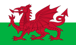
వేల్స్
స్వరూపం
వేల్స్ | |
|---|---|
| Location of వేల్స్ (dark green) – on the European continent (green & dark grey) – in the United Kingdom (green) Location of వేల్స్ (dark green) – on the European continent (green & dark grey) | |
| స్థాయి | దేశం |
| రాజధాని and largest city | కార్డిఫ్ 51°29′N 3°11′W / 51.483°N 3.183°W |
| Official languages |
|
| జాతులు (2021)[2] | జాబితా
|
| మతం (2021)[2] | జాబితా
|
| పిలుచువిధం | వెల్ష్ ప్రజలు |
| ప్రభుత్వం | Devolved parliamentary legislature within a parliamentary constitutional monarchy |
• Monarch | మూడవ చార్లెస్ |
| Eluned Morgan | |
| Parliament of the United Kingdom | |
| • Secretary of State | జో స్టీవెన్స్ |
| • House of Commons | 32 MPs (of 650) |
| శాసనవ్యవస్థ | సెనెడ్డ్ |
| Formation | |
• Unified by Gruffydd ap Llywelyn | 1057[3] |
| 3 March 1284[4] | |
| 1543[5] | |
| 27 July 1967[6] | |
| 1 July 1999[a][7] | |
| విస్తీర్ణం | |
• Total[b] | 21,218 కి.మీ2 (8,192 చ. మై.)[8] |
• Land[c] | [convert: invalid number][9] |
| జనాభా | |
• మూస:UK subdivision statistics year estimate | మూస:UK subdivision population[9] |
• 2021 census | 3,107,494[2] |
• జనసాంద్రత | [convert: invalid number][9] |
| GVA | 2022 estimate |
| • Total | £74.5 billion |
| • Per capita | £23,804[10] |
| GDP (nominal) | 2022 estimate |
• Total | £85.4 billion |
• Per capita | £27,274[11] |
| హెచ్డిఐ (2022) | very high |
| ద్రవ్యం | Pound sterling (GBP; £) |
| కాల విభాగం | UTC+0 (GMT) |
• Summer (DST) | UTC+1 (BST) |
| తేదీ తీరు | dd/mm/yyyy (AD) |
| వాహనాలు నడుపు వైపు | left |
| ఫోన్ కోడ్ | +44 |
| ISO 3166 code | [[ISO 3166-2:|]] |
| Internet TLD | .wales .cymru[d] |
వేల్స్ యునైటెడ్ కింగ్డం లోని ఒక దేశం. దీనికి ఉత్తర, పడమర దిక్కుల్లో ఐరిష్ సముద్రం, తూర్పున ఇంగ్లండ్, దక్షిణాన బ్రిస్టల్ చానల్ సరిహద్దులుగా ఉన్నాయి. 2021 నాటికి ఈ దేశ జనాభా సుమారు 32 లక్షలు. దీని మొత్తం వైశాల్యం 21,218 చ.కి.మీ. దీనికి 2700 కి.మీ మేర సముద్ర తీర ప్రాంతం ఉంది. ఈ దేశంలో అతి పెద్ద నగరం, రాజధాని కార్డిఫ్ నగరం. 5వ శతాబ్దంలో రోమన్లు బ్రిటన్ ను విడిచి వెళ్ళడంతో ఇక్కడ ఉన్న సెల్టిక్ బ్రిటన్స్ లో ప్రత్యేకమైన వెల్ష్ సంస్కృతి ఏర్పడింది.
గమనికలు
[మార్చు]- ↑ Date powers transferred to National Assembly
- ↑ ONS Standard Area Measurement, 'total extent of the realm' (area to mean low water)
- ↑ ONS Standard Area Measurement, 'area to mean high water excluding inland water'
- ↑ Both .wales and .cymru are not ccTLDs, but GeoTLDs, open to use by all people in Wales and related to Wales. .uk as part of the United Kingdom is also used. ISO 3166-1 is GB, but .gb is unused.
మూలాలు
[మార్చు]- ↑ "BBC Wales – Music – National Anthem – The background to Hen Wlad Fy Nhadau". www.bbc.co.uk. Retrieved 27 April 2024.
- ↑ 2.0 2.1 2.2 మూస:NOMIS2021
- ↑ Davies (1994) p. 100
- ↑ "Statute of Rhuddlan". Oxford Reference. Retrieved 26 July 2014.
- ↑ "Laws in Wales Act 1535 (repealed 21.12.1993)". legislation.gov.uk. Retrieved 26 July 2014.
- ↑ "Welsh Language Act". legislation.gov.uk. Retrieved 11 September 2022.
- ↑ "Government of Wales Act 1998". legislation.gov.uk. Retrieved 26 July 2014.
- ↑ "Standard Area Measurements for Administrative Areas (December 2023) in the UK". Open Geography Portal. Office for National Statistics. 31 May 2024. Retrieved 7 June 2024.
- ↑ 9.0 9.1 9.2 మూస:UK subdivision statistics citation
- ↑ "Regional gross value added (balanced) per head and income components". Office for National Statistics. 24 April 2024. Retrieved 15 May 2024.
- ↑ "Regional gross domestic product: all ITL regions". Office for National Statistics. 24 April 2024. Retrieved 15 May 2024.
- ↑ "Subnational HDI". Global Data Lab. Retrieved 30 September 2024.


