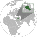
దస్త్రం:Kurdish-inhabited areas (orthographic projection with inset).svg
స్వరూపం

ఈ ఫైలు SVG కు చెందిన ఈ మునుజూపు PNG పరిమాణం: 512 × 512 పిక్సెళ్ళు. ఇతర రిజల్యూషన్లు: 240 × 240 పిక్సెళ్ళు | 480 × 480 పిక్సెళ్ళు | 768 × 768 పిక్సెళ్ళు | 1,024 × 1,024 పిక్సెళ్ళు | 2,048 × 2,048 పిక్సెళ్ళు.
అసలు దస్త్రం (SVG ఫైలు, నామమాత్రంగా 512 × 512 పిక్సెళ్ళు, ఫైలు పరిమాణం: 852 KB)
ఫైలు చరితం
తేదీ/సమయం ను నొక్కి ఆ సమయాన ఫైలు ఎలా ఉండేదో చూడవచ్చు.
| తేదీ/సమయం | నఖచిత్రం | కొలతలు | వాడుకరి | వ్యాఖ్య | |
|---|---|---|---|---|---|
| ప్రస్తుత | 03:25, 11 నవంబరు 2023 |  | 512 × 512 (852 KB) | Treetoes023 | Making border overlap easier to see. |
| 17:24, 28 సెప్టెంబరు 2023 |  | 512 × 512 (852 KB) | Golden | restoring previous edit but with the shading | |
| 02:15, 28 సెప్టెంబరు 2023 |  | 512 × 512 (794 KB) | Treetoes023 | Reverted to version as of 19:21, 13 June 2023 (UTC): Restoring shading. | |
| 20:09, 1 సెప్టెంబరు 2023 |  | 512 × 512 (885 KB) | Golden | rmv de facto countries with zero recognition (Somaliland, NKR) | |
| 19:21, 13 జూన్ 2023 |  | 512 × 512 (794 KB) | Isochrone | oops | |
| 19:17, 13 జూన్ 2023 |  | 512 × 512 (793 KB) | Isochrone | change per request | |
| 16:45, 5 జూన్ 2023 |  | 512 × 512 (836 KB) | Isochrone | Uploaded a work by {{u|Isochrone}} from {{own using}} * 1992 CIA map with UploadWizard |
లింకులు
కింది పేజీలలో ఈ ఫైలుకు లింకులు ఉన్నాయి:
సార్వత్రిక ఫైలు వాడుక
ఈ దస్త్రాన్ని ఈ క్రింది ఇతర వికీలు ఉపయోగిస్తున్నాయి:
- ar.wikipedia.org లో వాడుక
- ckb.wikipedia.org లో వాడుక
- en.wikipedia.org లో వాడుక
- got.wikipedia.org లో వాడుక
- incubator.wikimedia.org లో వాడుక
- ka.wikipedia.org లో వాడుక
- lo.wikipedia.org లో వాడుక
- lt.wikipedia.org లో వాడుక
- mr.wikipedia.org లో వాడుక
- ne.wikipedia.org లో వాడుక
- pl.wikipedia.org లో వాడుక
- qu.wikipedia.org లో వాడుక
- ru.wikipedia.org లో వాడుక
- simple.wikipedia.org లో వాడుక
- th.wikipedia.org లో వాడుక
- zh.wikipedia.org లో వాడుక

