దస్త్రం:Blank Map World Secondary Political Divisions.svg
Jump to navigation
Jump to search

ఈ ఫైలు SVG కు చెందిన ఈ మునుజూపు PNG పరిమాణం: 512 × 260 పిక్సెళ్ళు. ఇతర రిజల్యూషన్లు: 320 × 163 పిక్సెళ్ళు | 640 × 325 పిక్సెళ్ళు | 1,024 × 520 పిక్సెళ్ళు | 1,280 × 650 పిక్సెళ్ళు | 2,560 × 1,300 పిక్సెళ్ళు.
అసలు దస్త్రం (SVG ఫైలు, నామమాత్రంగా 512 × 260 పిక్సెళ్ళు, ఫైలు పరిమాణం: 2.38 MB)
This is a file from the Wikimedia Commons. Information from its description page there is shown below. Commons is a freely licensed media file repository. You can help. |
సారాంశం
| వివరణ |
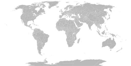
English: A detailed Robinson projection SVG map of the world with secondary political units grouped for easy coloring. |
| తేదీ | |
| మూలం | |
| కర్త |
|
లైసెన్సింగ్
నేను, ఈ కృతి యొక్క కాపీహక్కుదారుని, దీన్ని ఈ లైసెన్సు క్రింద ఇందుమూలముగా ప్రచురిస్తున్నాను:
| ఈ దస్త్రం క్రియేటివ్ కామన్స్ CC0 వెయివర్ క్రింద లభ్యం. | |
| ఈ కృతితో సంబంధమున్న వ్యక్తి తనకు ప్రపంచవ్యాప్తంగా కాపీహక్కుల చట్టం క్రింద ఈ కృతిపై ఉన్న అన్ని హక్కులని మరియు ఈ కృతిలో తనకి ఉన్న సంబంధిత న్యాయపరమైన హక్కులని, చట్టం అనుమతించిన మేరకు, వదులుకుని ఈ కృతిని కామన్స్కి అంకితమిచ్చారు. CC0 క్రింద ఉన్న కృతులకు ఆపాందింపు అవసరం లేదు. కృతిని ఉటంకించేప్పుడు, కృతికర్త యొక్క ఆమోదాన్ని మీరు అంతర్నిహితంగా సూచించకూడదు.
|
ఫైలు చరితం
తేదీ/సమయం ను నొక్కి ఆ సమయాన ఫైలు ఎలా ఉండేదో చూడవచ్చు.
| తేదీ/సమయం | నఖచిత్రం | కొలతలు | వాడుకరి | వ్యాఖ్య | |
|---|---|---|---|---|---|
| ప్రస్తుత | 03:22, 28 జూన్ 2024 | | 512 × 260 (2.38 MB) | ClaveScottPH | Fixed Greenland, some overlapping subdivisions, and others. Added subdivisions for Fiji, Malta, São Tomé and Príncipe, and Trinidad & Tobago. |
| 08:02, 25 జూన్ 2024 |  | 512 × 260 (9.25 MB) | ClaveScottPH | Fixed. | |
| 02:08, 22 జూన్ 2024 |  | 512 × 260 (3.45 MB) | ClaveScottPH | Fixed colors for comoros, fixed overlapping for Abkhazia, and added subdivisions for Bahrain. | |
| 14:06, 20 జూన్ 2024 |  | 512 × 260 (2.47 MB) | ClaveScottPH | Fixed division for the Central African Republic, Montenegro, and Thailand; fixed overlapping divisions for Morocco, Nigeria, Palestine, South Ossetia (disputed), and Taiwan (disputed). | |
| 06:50, 10 జూన్ 2024 |  | 512 × 260 (2.42 MB) | ClaveScottPH | Fixed | |
| 04:01, 10 జూన్ 2024 |  | 3,413 × 1,752 (5.9 MB) | ClaveScottPH | {{subst:update-note|1=File:Blank Map World Secondary Political Divisions.svg|2=new cantons in Luxembourg, municipalities in Latvia, new regions in Chile, Tanzania, the Philippines, Mali, Kazakhstan, Ghana, and Ethiopia, new prefectures in the Central African Republic, new provinces in Equatorial Guinea, Burundi, Algeria, Laos, Indonesia, Nepal, and the Democratic Republic of the Congo, new governorates in Lebanon and Oman, new administrative area in South Sudan have been created.}} ~~~~ | |
| 19:10, 28 మే 2022 |  | 2,560 × 1,314 (4.59 MB) | Betseg | Reverted to version as of 00:32, 13 March 2022 (UTC). Nearly double the size because of the high detailed divisions, and the colours were broken. | |
| 21:47, 7 మే 2022 |  | 2,560 × 1,314 (7.27 MB) | Abbasi786786 | Made Pakistan and Nigeria more precise; Added new Congolese provinces | |
| 00:32, 13 మార్చి 2022 |  | 2,560 × 1,314 (4.59 MB) | Abbasi786786 | Merged KPK and former FATA, Pakistan | |
| 11:20, 13 డిసెంబరు 2021 |  | 2,560 × 1,314 (4.59 MB) | W0nderhat | Reverted to version as of 18:26, 6 June 2020 (UTC); removal of Chilean Patagonia unnecessary and confusing, ISO codes an unfortunate casualty (will look into how to restore them) |
లింకులు
కింది పేజీలలో ఈ ఫైలుకు లింకులు ఉన్నాయి:
సార్వత్రిక ఫైలు వాడుక
ఈ దస్త్రాన్ని ఈ క్రింది ఇతర వికీలు ఉపయోగిస్తున్నాయి:
- bn.wikipedia.org లో వాడుక
- bs.wikipedia.org లో వాడుక
- en.wikipedia.org లో వాడుక
- Government
- Administrative division
- Wikipedia:Blank maps
- Wikipedia:Graphics Lab/Map workshop/Archive/May 2011
- User:Naqsh-e hJahan/List of provinces
- User talk:Naqsh-e hJahan/List of provinces
- Wikipedia:Graphics Lab/Illustration workshop/Archive/Jun 2023
- Wikipedia:Graphics Lab/Map workshop/Archive/Jul 2023
- ja.wikipedia.org లో వాడుక
- ne.wikipedia.org లో వాడుక
- sq.wikipedia.org లో వాడుక
- sr.wikipedia.org లో వాడుక
- tr.wikipedia.org లో వాడుక
- zh.wikipedia.org లో వాడుక